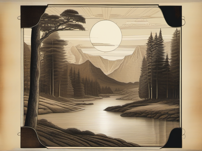
How to Read a Landscape: Water, Soil, and Shelter in 10 Minutes
Your great-grandparents could walk onto a piece of land and know within minutes where the water was, which soil would grow food, and where to build a house that would stand for a century. That skill isn't lost — it's just unlearned. Here's the 10-minute protocol that reads a landscape like an open book.
The Lost Literacy
There is a kind of reading that has almost vanished from the industrialized world. Not reading text — reading terrain. Reading the language of slope and hollow, of leaf shape and soil color, of where frost gathers and where water hides.
Two hundred years ago, a settler family arriving at an unfamiliar piece of ground could decode it in the time it takes us to check a weather app. They would note the angle of the hillside and the species growing on it. They would dig a hand into the earth and roll it between their fingers. They would watch where the morning fog collected and where the afternoon wind came from. Within minutes, they had answers to the questions that mattered: Where is the water? What will the soil grow? Where do we build so the house stands for a hundred years?
This was not intuition. It was not some mystical communion with nature. It was a practical, trainable skill — a vocabulary of observation that every competent farmer, shepherd, and woodsman possessed. It was taught by doing, passed from parent to child on the walk between the barn and the far field.
We lost it not because the knowledge disappeared but because we stopped needing it. Municipal water, commercial fertilizer, GPS-guided tractors, and climate-controlled buildings made landscape literacy seem quaint. Why read a slope when you can grade it flat with a bulldozer? Why find a spring when you can drill a well anywhere?
The answer is becoming obvious again. Energy costs are rising. Aquifers are dropping. The people returning to the land — whether on one acre or one hundred — are discovering that the old knowledge was not just charming. It was efficient. It worked with the landscape rather than against it, which meant less labor, less fuel, less money, and less catastrophic failure when things went wrong.
This article is a field manual for relearning that literacy. By the end of it, you will have a structured 10-minute protocol for reading any piece of land in the temperate world. You will know what the plants are telling you about water. You will know what the soil color means. You will understand why your great-grandmother's farmhouse sits exactly where it does and not fifty yards in any direction.
None of this requires expensive equipment. You need your eyes, your hands, a mason jar, and roughly the attention span of a decent podcast episode.
Part I: The Hierarchy of Landscape — What to Read First
Yeomans' Scale of Permanence
In 1954, an Australian mining engineer and farmer named Percival Alfred Yeomans published The Keyline Plan, a book that would quietly reshape how thoughtful land managers think about property design. Yeomans had spent fifteen years experimenting on his own properties outside Sydney, and he arrived at a principle that now seems obvious but was revolutionary at the time: design from the most permanent features down to the least permanent.
He called it the Scale of Permanence, and it looks like this:
- Climate — the given you cannot change
- Landform — the topography; slopes, ridges, valleys
- Water — where it falls, where it flows, where it collects
- Roads — access and circulation
- Trees — the long-lived structural vegetation
- Buildings — structures placed after everything above is understood
- Subdivision — fencing, garden beds, management zones
- Soil — the element you can most readily improve
The logic is elegant. Climate determines what is possible. Landform determines where water goes. Water determines where life concentrates. Each layer constrains and informs the layers below it. When you violate this hierarchy — when you place a building before understanding water flow, or cut roads before reading the landform — you create problems that are expensive or impossible to fix.
Most modern development works from the bottom up: choose a building site, grade the land to suit it, pipe in water, and hope for the best. The Scale of Permanence works from the top down. You observe first, design second, build third.
This is not abstract philosophy. It is the order in which you should read a landscape.
Mollison's Observation Principle
Bill Mollison, co-founder of the permaculture movement and author of the encyclopedic Permaculture: A Designer's Manual (1988), reduced the principle to a single maxim that deserves to be carved in stone above every land management office in the world:
"Protracted and thoughtful observation rather than protracted and thoughtless labor."
Mollison advocated observing a property through all four seasons before making any major design decisions. A full year of observation reveals the frost pockets, the seasonal water flows, the wind corridors, and the sun angles that no single visit can capture. But Mollison also knew that people buying land or evaluating a new site do not always have a year to wait. His design methodology included rapid site-assessment techniques that could yield the critical information in a single structured visit.
The 10-minute protocol in this article synthesizes Yeomans' hierarchy with Mollison's observational methods and adds the practical field indicators that settler families carried in their heads. It is not a substitute for extended observation. But it will tell you, in ten minutes, the things you need to know before you make any commitment to a piece of ground.

Part II: Reading Water
Water is the single most important feature of any landscape. Where it is, where it flows, and how much of it exists underground will determine more about what you can do with a piece of land than any other variable.
Surface Water: What the Topography Tells You
You do not need a contour map to read water flow, though one helps. You need to understand a single principle: water flows perpendicular to contour lines. Since contour lines connect points of equal elevation, water always takes the steepest path downhill, crossing those invisible lines at right angles.
Stand on any slope and look for the natural drainage patterns. After rain, these are obvious — you can see the rivulets and gullies. In dry weather, look for:
- Erosion patterns. Gullies, rills, and fan-shaped deposits of gravel or silt mark where water concentrates during storms. A gully tells you not just where water flows but how fast — deep, narrow gullies mean high-velocity flow from a concentrated catchment.
- Vegetation lines. A strip of taller, greener vegetation running across a slope marks a seep line or subsurface water flow. This is one of the most reliable landscape indicators you will ever learn. When surrounding grass is brown and dormant, a bright green line across a hillside is water writing its own contour map.
- Concave vs. convex landforms. Concave surfaces (hollows, swales, valley floors) collect water. Convex surfaces (ridges, hilltops, noses of slopes) shed water. This is elementary, but its implications are profound. A garden on a convex slope will need irrigation. The same garden relocated to a concave position fifty yards away may never need supplemental water.
The Keypoint: Reading a Valley
Yeomans' most elegant contribution to landscape reading is the concept of the keypoint. In any valley, there is a specific location where the valley floor changes from relatively gentle to noticeably steeper. This is the keypoint. Above it, the valley is broad and shallow. Below it, the valley narrows and steepens as water accelerates toward the main drainage.
The keypoint matters because it marks the boundary between water that can be cheaply stored or infiltrated (above) and water that is hard to capture (below). A dam or pond at the keypoint captures the maximum water from the minimum earthworks. Water harvested above the keypoint can be gravity-fed across the widest possible area of the property.
To find the keypoint, walk up a valley from its mouth. At some point, the grade beneath your feet will noticeably flatten. That transition — steep to less steep — is the keypoint. Mark it. This is arguably the single most valuable spot on the property for water infrastructure.
The keyline itself is the contour line that passes through the keypoint. Yeomans' keyline cultivation system — plowing parallel to this line but slightly off-contour — spreads water from the wet valleys onto the drier ridges, dramatically accelerating soil building and pasture growth. But even if you never plow a keyline furrow, knowing where the keypoint is tells you where to put a pond, where gravity irrigation is feasible, and where the landscape transitions from gentle catchment to steep drainage.
Subsurface Water: What the Plants Tell You
Plants are the most reliable instruments for detecting underground water. Certain species — called phreatophytes — have root systems that reach down to the water table, and their presence is a direct indicator of subsurface water depth and reliability.
High Water Table (0-3 meters / 0-10 feet)
The following plants indicate a water table within roughly three meters of the surface:
- Willows (Salix spp.) — The classic water indicator. Where willows grow naturally (not planted), water is close. In arid landscapes, a line of willows in a valley bottom is as clear a signal as a neon sign reading "water here." Willow roots can reach water tables up to 10 meters deep, but natural stands typically indicate 1-3 meters.
- Cattails / Bulrushes (Typha spp.) — Standing water or a water table at or very near the surface. If you see cattails, you are looking at either permanent surface water or ground that stays saturated year-round. This is wetland. It is valuable — but it is not where you plant tomatoes.
- Rushes (Juncus spp.) — Seasonal or permanent saturation. Rushes tolerate a wider range of conditions than cattails, growing in areas that are waterlogged in winter and merely damp in summer. A rush-dominated meadow indicates poor drainage and a high water table, typically within one meter.
- Sedges (Carex spp.) — Another saturated-soil indicator. The old field botanists had a mnemonic: "Sedges have edges, rushes are round, grasses have knees that bend to the ground." If the stem you are holding has a triangular cross-section, it is a sedge, and you are standing on wet ground.
- Cottonwoods (Populus spp.) — In western North America, cottonwoods along a creek bed indicate reliable subsurface flow even when the creek is dry on the surface. They are riparian obligates — they need their roots in or near the water table.
- Alders (Alnus spp.) — Another riparian indicator, particularly in the Pacific Northwest and northern Europe. Alders also fix nitrogen, so their presence indicates both water and naturally enriched soil.
- Poplars and Aspens (Populus tremuloides, P. nigra) — In cool climates, aspen groves often mark seep areas or springs. Their bright green canopy in summer and golden leaves in autumn make them visible from considerable distances.
Deep Water Table (3-10 meters / 10-30 feet)
- Mesquite (Prosopis glandulosa) — In arid and semi-arid regions of the American Southwest and Mexico, mesquite is the deep-water specialist. Its taproot has been documented reaching over 50 meters (160 feet) in extreme cases, though 10-20 meters is more typical. In desert landscapes, a mesquite bosque (thicket) indicates water at depth — not surface water, but a reliable aquifer. Wells drilled near mesquite stands in desert environments have a significantly higher success rate than random placement.
- Saltcedar / Tamarisk (Tamarix spp.) — An invasive species in North America but a reliable water indicator nonetheless. Tamarisk colonizes areas with subsurface water in arid environments, typically where the water table is between 3 and 10 meters deep.
- Ash (Fraxinus spp.) — In temperate Europe and North America, mature ash trees in hedgerows and field margins often indicate a moderately deep but reliable water supply.
Spring and Seep Indicators
Springs — locations where groundwater reaches the surface — are among the most valuable features on any property. Historically, more homesteads were sited near springs than near any other water source. Springs indicate:
- A reliable water supply that is less affected by seasonal drought than surface streams
- Water that has been naturally filtered through geological strata
- A water table that is being recharged from a higher elevation (the spring's catchment area)
Look for an area where vegetation is conspicuously lusher than its surroundings, especially on a slope. A patch of green during a brown summer, a cluster of moisture-loving plants (ferns, mosses, watercress, jewelweed) in an otherwise dry area, or a consistent boggy spot that does not dry out even in drought — these are spring indicators.
Contact springs occur where a permeable layer (sandstone, gravel) sits atop an impermeable layer (clay, shale, bedrock). Water percolating down through the permeable layer hits the impermeable layer and moves laterally until it emerges on a hillside. You can sometimes identify the geological boundary by the change in vegetation or the presence of a distinct line of seepage across a slope.
Other signs of spring activity:
- Iron-staining (orange or rust-colored deposits) on rocks or soil in a wet area — this indicates mineral-rich groundwater reaching the surface
- Watercress (Nasturtium officinale) growing in or near a trickle of water — watercress almost exclusively grows in spring-fed water
- Year-round green moss on rocks in an otherwise dry gully
- A slight temperature difference — spring water maintains a relatively constant temperature (typically 10-15 degrees C / 50-59 degrees F in temperate regions), so the air near a spring feels cooler in summer and warmer in winter relative to the surroundings
The Two-Minute Water Summary
In the first two minutes of your landscape reading, you should be able to answer:
- Which direction does water flow across this property?
- Where are the concave (water-collecting) areas?
- Is there evidence of a high water table? (phreatophytes, green lines, boggy spots)
- Where is the keypoint in any visible valleys?
- Are there spring indicators? (lush patches, iron staining, watercress)
Part III: Reading Soil
Soil is the foundation of everything a landscape can produce. The good news is that soil is also the most improvable element on Yeomans' Scale of Permanence — it sits at the bottom precisely because human action can transform poor soil into productive soil within a few seasons. But first you need to know what you are starting with.
The Hand Test: 30 Seconds
Pick up a handful of moist soil (not wet, not bone dry — moist, like a wrung-out sponge). Squeeze it in your fist. Open your hand.
- Sandy soil: Falls apart immediately. Feels gritty. Individual grains visible. You cannot form a ribbon when you try to roll it between your thumb and forefinger.
- Clay soil: Holds its shape firmly. Feels slick and sticky when wet. You can roll a thin ribbon between thumb and forefinger that extends 5 centimeters (2 inches) or more before breaking.
- Silt soil: Feels smooth and silky, almost like flour. Holds shape loosely. Forms a short, crumbly ribbon.
- Loam: The ideal. A balanced mix that holds shape when squeezed but crumbles when poked. Gritty and smooth simultaneously. Forms a ribbon of 1-2 centimeters before breaking.
This takes thirty seconds and tells you more about your soil than most homeowners learn in a decade of gardening.
What these textures mean in practice:| Texture | Drainage | Water Retention | Fertility | Workability |
|---|---|---|---|---|
| Sand | Excellent (too fast) | Poor | Low (nutrients leach) | Easy |
| Clay | Poor (too slow) | Excellent | High (nutrients bind) | Difficult when wet |
| Silt | Moderate | Good | Moderate | Compacts easily |
| Loam | Balanced | Balanced | High | Ideal |
The Mason Jar Test: Precision at Home
The hand test gives you a quick field read. The mason jar test gives you actual percentages. It is the single most useful soil test you can perform without a laboratory, and it costs nothing.
Materials:- A clean, straight-sided glass jar (a quart mason jar is ideal)
- A ruler
- A permanent marker
- A watch or timer
- A mesh sieve, kitchen strainer, or old window screen
- Collect your sample. Dig down past the surface litter and top inch of soil. Take soil from 5-15 centimeters (2-6 inches) depth — this is the active root zone. If you are assessing a property, take samples from several locations and test them separately. Soil can vary dramatically across short distances.
- Prepare the soil. Sift it through your mesh to remove rocks, roots, twigs, and large organic debris. Break up clods with your fingers. You want mineral soil, not chunks.
- Fill the jar one-third full with prepared soil.
- Add water to fill the jar to about three-quarters full. Add a tablespoon of dish soap or water softener — this helps disperse the clay particles.
- Cap the jar tightly and shake vigorously for two to three minutes. You want a completely uniform slurry with no clumps.
- Set the jar on a level surface and start timing.
- After 1 minute: Mark the top of the settled layer. This is your sand fraction. Sand particles are the heaviest and settle first. Coarse sand drops out within seconds; fine sand within a minute.
- After 2 hours: Mark the top of the newly settled layer. The material between your first mark and this mark is silt. Silt particles are lighter than sand but heavier than clay.
- After 48 hours: Mark the top of the final settled layer. The material between your 2-hour mark and this mark is clay. The water above may still be slightly cloudy — that is colloidal clay, the finest fraction, and it can take weeks to fully settle. For practical purposes, 48 hours is sufficient.
- Measure and calculate. Using your ruler, measure the total height of settled solids. Measure the height of each layer (sand, silt, clay). Calculate the percentage of each:
- % Sand = (sand layer height / total height) x 100 - % Silt = (silt layer height / total height) x 100 - % Clay = (clay layer height / total height) x 100
Interpreting your results:The USDA Soil Texture Triangle classifies soils based on their sand/silt/clay percentages. Here are the key thresholds:
- Ideal garden loam: approximately 40% sand, 40% silt, 20% clay
- Sandy loam: 50-70% sand, 20-30% silt, less than 20% clay — drains fast, needs organic matter
- Clay loam: 20-45% sand, 15-55% silt, 27-40% clay — rich but heavy, needs drainage improvement
- Heavy clay: more than 40% clay — difficult raw material, but responds dramatically to organic matter addition
- Pure sand: more than 85% sand — needs massive organic matter amendment; consider raised beds with imported soil
Soil Color: Reading the History
Soil color is a compressed record of what has happened in that spot over centuries. Learning to read it takes about ten seconds per sample.
Dark brown to black: High organic matter content. This is the most favorable color for growing food. Dark topsoil indicates active biological decomposition — leaf litter, root material, and humus accumulating faster than they decompose. The darker the soil, the more organic carbon it contains. In prairie and grassland regions, topsoil can be black to depths of a meter or more, built over millennia by deep-rooted perennial grasses. This is the soil that grew the breadbaskets of the world.A practical benchmark: if your soil is darker than a paper grocery bag, organic matter content is likely above 3%. If it is approaching black, you may be above 5-6%. Either of these is excellent for food production.
Red to reddish-orange: Iron oxide accumulation in well-aerated, well-drained conditions. Red soils (think Georgia clay, Australian outback, parts of Normandy) indicate that the soil has been exposed to oxygen over long periods. The iron has fully oxidized, like rust. Red soil is not inherently bad — many red soils are productive — but the color tells you about drainage history. This soil has not been waterlogged. Yellow to yellowish-brown: Iron accumulation under slightly less oxygenated conditions than red soil. Common in subtropical and humid temperate regions. The yellow comes from hydrated iron oxides (goethite rather than hematite). These soils are often moderately well-drained. Grey to blue-grey: This is the signal to pay attention. Grey soil — technically called "gleyed" soil — indicates prolonged waterlogging. In anaerobic (oxygen-starved) conditions, microbes reduce the ferric iron (Fe3+, which is red) to ferrous iron (Fe2+, which is grey-blue or greenish). If you dig down and hit grey soil, you are looking at the zone where the water table sits for extended periods during the year.Grey soil is not necessarily a problem. It tells you something important: this ground is seasonally or permanently saturated. Plant accordingly. Do not build a septic system here. Do not put a basement here. But a rice paddy, a wetland filtration system, or a pond would be perfectly appropriate.
Mottled (mixed patches of red/orange and grey): The most informative pattern. Mottling indicates a fluctuating water table — the soil is waterlogged part of the year and aerated part of the year. The red/orange spots are where iron oxidized during dry periods. The grey spots are where it reduced during wet periods. Mottled soil at 30 centimeters depth means the water table rises to that level during the wet season. This has direct implications for foundation depth, septic placement, and what you can grow. White: Indicates salt accumulation, calcium carbonate (lime), or leached minerals. In arid regions, a white crust on the soil surface is almost certainly salt — a serious problem for agriculture. In humid regions, a white or very pale layer beneath the topsoil is a leached horizon (called an E horizon) — the organic acids from surface decomposition have washed the color and nutrients out of this layer. It is a natural process in forested soils and not a problem per se, but it tells you that the subsoil beneath it probably contains the accumulated clay and iron that washed down from above.The Earthworm Census
This is the simplest and most reliable biological indicator of soil health. Dig a cube of soil approximately one spade-width in each dimension (roughly 25 x 25 x 25 centimeters, or 10 x 10 x 10 inches). Count the earthworms.
- 0 earthworms: Soil is severely degraded, compacted, chemically contaminated, or too dry/too wet for earthworms. Investigate further.
- 1-5 earthworms: Poor to moderate soil health. The soil is alive but not thriving. Organic matter inputs and reduced disturbance will improve this over time.
- 5-10 earthworms: Moderate to good. The soil biology is functional. Most food crops will grow here with reasonable management.
- 10+ earthworms: Excellent. You are looking at biologically active soil with good structure, adequate organic matter, and healthy microbial communities. On rich organic soils, you may find 20-30 or more per shovelful.
Earthworms are not just indicators — they are engines. Their casts (droppings) contain five times more available nitrogen, seven times more available phosphorus, and eleven times more available potassium than the surrounding soil. A healthy earthworm population processes tons of organic matter per acre per year, building soil structure and fertility as they go.
If your earthworm count is low but other indicators (color, texture, moisture) are reasonable, the most likely culprits are:
- Recent or heavy tillage (physically disrupts burrows and kills worms)
- Chemical inputs (synthetic fertilizers, especially ammonium-based, and pesticides)
- Compaction from machinery or livestock
All three are reversible. Stop tilling, stop spraying, manage traffic — and the worms come back.
The Two-Minute Soil Summary
In minutes two through four of your landscape reading, you should be able to answer:
- What is the basic soil texture? (hand test: sand, silt, clay, or loam)
- What color is the topsoil? (dark = organic, red = drained, grey = waterlogged)
- How deep is the topsoil before you hit a color change?
- Are there earthworms? How many?
- Is there mottling in the subsoil? (indicates seasonal water table)
Take a soil sample for the mason jar test. You will run that at home later.
Part IV: Reading Aspect and Solar Exposure
After water and soil, the single greatest influence on what a piece of land can do is how it faces the sun.
The Geometry of Slope and Sun
In the Northern Hemisphere, south-facing slopes receive the most direct solar radiation. The difference is not subtle. A south-facing slope at 45 degrees latitude receives roughly two to three times more solar radiation per unit area during the growing season than an equivalent north-facing slope. At higher latitudes and during winter, the difference becomes even more dramatic.
In the Southern Hemisphere, the orientation reverses — north-facing slopes are the warm, sunny ones.
This has cascading effects:
Temperature. South-facing slopes are warmer. Soil temperatures on a south-facing slope in spring can be 5-10 degrees Celsius (9-18 degrees Fahrenheit) warmer than on a north-facing slope at the same elevation and the same time of year. This translates directly into growing season length. Growing season. A south-facing slope at moderate latitudes (40-55 degrees N) effectively gains two to four weeks of growing season compared to a north-facing slope. Seeds germinate earlier. Frost comes later. Heat-loving crops (tomatoes, peppers, melons) that struggle on a north-facing slope may thrive on a south-facing one just across the valley. Moisture. South-facing slopes are drier. More sun means more evaporation. In dry climates, this is a disadvantage — south-facing slopes may be too dry for productive agriculture without irrigation. In wet climates, it is an advantage — south-facing slopes drain and warm up faster in spring, allowing earlier planting. Vegetation. Natural vegetation often differs dramatically between north and south aspects. In the mountains of Idaho, for instance, north-facing slopes support dense forests of ponderosa pine and Douglas fir, while south-facing slopes across the same valley support only sparse, drought-adapted scrub. In the Swiss Alps, farming is concentrated on south-facing slopes while north-facing slopes remain forested. These natural vegetation patterns are your best guide to what a slope can support.Practical Implications
For buildings: In the Northern Hemisphere, site your house with its longest wall facing south (within 15 degrees of true south is optimal). This maximizes passive solar gain in winter and can reduce heating costs by 30-50%. Your great-grandparents knew this instinctively. If you visit old farmhouses in New England, the Upper Midwest, or Northern Europe, you will find that the vast majority face south or southeast. They were not following building codes — they were reading the landscape. For gardens: Place your primary food garden on a south-facing slope or on the south side of a building. Even a gentle slope of 5-10 degrees makes a measurable difference. If your only option is flat ground, create a south-facing micro-slope by building raised beds that are slightly higher on the north side — even 15 centimeters of rise over 1.2 meters of width creates a noticeable warming effect. For orchards: Counterintuitively, some fruit trees (particularly stone fruits like peaches, cherries, and apricots) may perform better on a north-facing or east-facing slope in regions with late spring frosts. The reason: a south-facing slope warms early, stimulating early bloom. If a late frost follows, the blossoms are killed and the crop is lost. A north-facing slope delays bloom by one to two weeks, often enough to dodge the last frost. Old orchardists called this "holding the bloom back." It is one of the subtlest pieces of landscape reading, and it has saved more fruit crops than any fungicide. For livestock: Animals need shade in summer and shelter from wind in winter. North-facing slopes hold snow longer and stay cooler — poor for winter grazing but excellent for summer shade. South-facing slopes clear of snow first in spring, providing the earliest grazing.Reading Aspect in the Field
You do not need a compass for a rough assessment (though one helps). At midday in the Northern Hemisphere, the sun is due south. If the slope you are standing on faces the sun at noon, it is south-facing. If you are in shade at noon with the sun behind the ridge, it is north-facing.
For more precision: the shadow of a vertical stick at solar noon points due north (in the Northern Hemisphere). Plant a stick, mark the shadow tip at midday, and you have a bearing.
Note the angle of the slope, not just its direction. A steep south-facing slope receives more concentrated solar radiation than a gentle one, but it also sheds water faster and is more prone to erosion. A gentle south-facing slope (5-15 degrees) is usually the ideal combination of warmth and moisture retention.
Part V: Reading Frost
Frost kills more gardens, orchards, and livelihoods than drought. Understanding where frost collects in a landscape is one of the highest-value pieces of landscape literacy you can acquire.
Cold Air Drainage: The Physics
Cold air is denser than warm air. Dense air sinks. This is the entire mechanism of frost pocket formation, and it is as predictable as water flowing downhill.
On a clear, calm night, the ground surface radiates heat into the sky. The air immediately above the ground cools. This cold, dense air begins to flow downhill, following the same paths that water follows — gullies, valleys, depressions. At the bottom of the slope, it collects. If there is no outlet — if the valley is closed at the bottom, or if a wall, dense hedge, or road embankment blocks the drainage — the cold air pools.
The result is a frost pocket: a localized area that can be 5-10 degrees Celsius (9-18 degrees Fahrenheit) colder than a slope just 20-30 meters higher in elevation. The frost pocket gets frost first in autumn and last in spring. Its growing season may be two to six weeks shorter than the adjacent slope.
This is not a subtle or rare phenomenon. It happens on virtually every piece of land with any topographic variation. And it has enormous practical consequences.
How to Identify Frost Pockets
Look for the low spots. Valley floors, closed basins, hollows, the bottom of bowls — any place where cold air can collect and cannot drain away. Look for cold-air dams. A dense hedgerow, a solid fence, a road embankment, or a tree line running across a slope can trap cold air on its uphill side, creating an artificial frost pocket. Old farmers knew this and deliberately left gaps in hedgerows at the lowest points of slopes — these gaps served as "cold-air drains" that let the dense, cold air flow through and continue downhill rather than pooling behind the hedge. Look for the vegetation evidence. In spring, frost pockets are often visible as patches where growth is delayed compared to surrounding slopes. In autumn, they are visible as patches where frost damage appears first. Year-round, the vegetation in chronic frost pockets tends to be different — you may see cold-tolerant species (sedges, certain grasses) in the hollow while the surrounding slopes support more tender plants. Look for morning fog. Fog collects in the same places that cold air collects. If you visit a property at dawn and see fog pooling in a hollow while the slopes above are clear, you are looking at a frost pocket. This is one of the most reliable visual indicators, and it is why Bill Mollison recommended visiting a property at dawn whenever possible. The frost-line indicator. On a cold morning, frost (or dew) on the grass will be heaviest in the frost pocket and may extend partway up the slope before disappearing. The line where frost gives way to dry grass marks the upper boundary of the cold-air pool. Everything below that line is in the frost zone.Practical Implications
Plant tender crops on slopes, not valley floors. This is the single most violated principle in small-scale agriculture. People naturally want to garden in flat, low-lying areas — the soil is often deeper, water is more available, and the ground is easier to work. But the flat valley floor is precisely where frost collects. Your tomatoes, peppers, beans, squash, and fruit trees should be on the slope above the frost pocket, not in it. Use the frost pocket for what it does best. Cold-tolerant and cold-requiring crops can go in the bottom. Root cellars and cold storage benefit from the cooler air. Wetland species that tolerate or require cold conditions may thrive here. Manage cold-air flow. If you inherit a frost pocket created by a solid barrier, you may be able to open it up. Replacing a solid fence with an open one, thinning a dense hedge at the low point, or cutting a gap in an embankment can allow cold air to drain through and significantly reduce frost severity. Site buildings above the frost pool. Traditional farmhouses in hilly country are almost never on the valley floor. They sit partway up the slope — high enough to be above the frost pool, low enough to be sheltered from the wind. This is not accident. It is hundreds of years of accumulated landscape reading encoded in building placement.Part VI: Reading Wind
Wind is energy. It can be useful (ventilation, windmill power, drying grain) or destructive (crop damage, heat loss from buildings, erosion, desiccation of soil and plants). Reading the wind patterns of a landscape lets you harness the useful and mitigate the destructive.
Prevailing Wind Direction
Every location has a prevailing wind — the direction from which wind comes most frequently. In much of the temperate Northern Hemisphere, prevailing winds are from the west or southwest. But local topography modifies this dramatically.
How to read prevailing wind without instruments:- Flag trees. Trees on exposed ridges and hillsides are shaped by the wind. Branches grow preferentially on the leeward side (away from the wind). On severely wind-exposed sites, trees may be flagged — all branches on the windward side stripped away, the remaining branches extending like a flag in one direction. The branches point away from the prevailing wind.
- Snow drift patterns. In winter, snow accumulates on the leeward side of obstacles. Snowdrifts behind hedges, walls, and buildings indicate the prevailing wind direction. The drift is on the sheltered side.
- Lean of vegetation. Grasses, shrubs, and small trees on exposed sites may lean permanently away from the prevailing wind.
- Lichen patterns. On rocks and tree trunks, lichen growth is often more vigorous on the side sheltered from the prevailing wind (and driving rain).
- Erosion patterns. Wind erosion on soil surfaces, sand accumulation, and dune formation all indicate wind direction and intensity.
Topographic Channeling
Wind does not just blow uniformly across a landscape. Topography channels, accelerates, and redirects it.
Gaps and saddles. Wind accelerates through gaps in ridges, saddles between hills, and narrow valleys oriented parallel to the wind. These are the windiest spots in any landscape and the worst locations for buildings or tender crops. They are, however, excellent for wind power generation. Venturi effect. When wind is forced through a constriction (between two hills, through a narrow gap in a tree line), it speeds up. A gentle breeze on the open hillside can become a gale through the gap. Old farmsteads are never located in such constrictions. Lee eddies. On the downwind side of a hill or ridge, wind can create turbulent eddies — swirling, unpredictable air currents that are worse for structures and vegetation than the steady prevailing wind itself. This is why the ideal building site is not directly behind a windbreak but offset to one side or set back far enough to be beyond the turbulence zone. Valley winds. In mountainous terrain, valleys develop their own daily wind patterns driven by differential heating. During the day, slopes heat up and warm air rises, drawing cooler air up from the valley floor (a "valley breeze"). At night, slopes cool and cold air drains into the valley (a "mountain breeze" — which is also the mechanism behind frost pockets). These thermal winds can be significant and may override the prevailing wind during calm conditions.Windbreaks: The Protection Zone
A windbreak — a line of trees or a hedge perpendicular to the prevailing wind — is one of the most cost-effective improvements you can make to a property. The protection zone extends downwind for a distance proportional to the height of the windbreak.
The rule of thumb: Wind speed reaches its minimum at about 3 to 5 times the height of the windbreak. Measurable protection extends to approximately 10 to 15 times the height. Beyond that, wind speed has essentially returned to its unobstructed value.So a 10-meter (33-foot) tall windbreak provides: - Maximum protection (50-80% wind speed reduction) at 30-50 meters downwind - Useful protection (20-50% reduction) out to 100-150 meters downwind
Porosity matters. A solid wall creates a zone of turbulence immediately behind it as wind swirls over the top and back down. A porous windbreak (about 40-60% density — think a row of deciduous trees, not a solid board fence) lets some wind through, smoothing the flow and extending the protection zone. The ideal windbreak is moderately dense at the base and more open at the top, or a mix of heights including an understory. Effects on microclimate:A windbreak does more than slow wind. In the protected zone: - Air temperature increases slightly (the slowed wind dissipates heat from the sun less effectively) - Evaporation decreases (less wind = less moisture loss from soil and plants) - Humidity increases (reduced evaporation keeps more moisture in the air) - Crop yields increase — multiple studies document 15-35% yield improvements in the protected zone of well-designed windbreaks
Effects on snow:In cold climates, windbreaks accumulate snow on the leeward side. This is either an advantage (snow = spring moisture = free irrigation) or a disadvantage (snow drifting onto roads or building roofs). Farmers traditionally placed windbreaks to capture snow on fields and keep it off roads — a deliberate landscape design decision.
The Two-Minute Wind and Shelter Summary
In minutes four through six of your landscape reading:
- What is the prevailing wind direction? (flag trees, lean, drift patterns)
- Are there topographic features channeling or accelerating wind?
- Where are the sheltered areas? (lee of hills, existing tree lines)
- Where would a windbreak do the most good?
- Are there cold-air drainage paths that also serve as wind corridors?
Part VII: Why Old Farmhouses Are Where They Are
If you want a masterclass in landscape reading, study the placement of farmhouses built before 1900 — before cheap energy, before bulldozers, before municipal water and sewer. Those houses were sited by people who read landscapes for a living, and the patterns are remarkably consistent.
The Classic Farmstead Position
In hilly country across the temperate Northern Hemisphere — New England, the Upper Midwest, Britain, Scandinavia, Central Europe — the traditional farmhouse position follows a remarkably consistent logic:
Partway up a south-facing slope.Not on the hilltop (too exposed to wind). Not on the valley floor (too cold, too wet, too prone to flooding). Partway up. Typically one-third to one-half of the way between the valley floor and the ridge. This position provides:
- Above the frost pocket. Cold air drains past the house site and pools below.
- Below the wind. The ridge above provides shelter from the worst of the prevailing wind. The house is in the "wind shadow" of the hillside without being in the turbulence zone.
- South-facing for solar gain. The long wall of the house faces south (or southeast, to catch the morning sun and reduce dampness). Passive solar heating is not a modern invention — it is an ancient survival strategy.
- Near the spring. Springs emerge from hillsides, not hilltops or valley floors. The classic farmhouse position often corresponds exactly with the elevation of a spring or seep line. Many old farmhouses have a spring house — a small stone structure built directly over a spring — within 50 meters of the main house.
- Above the good soil. The deepest, richest soil accumulates on the lower slopes and valley floors through erosion and deposition. The farmhouse sits above this productive ground, which is reserved for crops rather than buildings.
- On well-drained ground. Partway up a slope means the soil beneath the house drains freely. Water moves downhill past the foundation rather than pooling under it. This keeps the house dry and the foundation sound.
- With a view of the property. From the classic position, the farmer can see the fields below, the access road, and approaching weather.
The Barn Position
The barn typically sits slightly downhill from the house — lower on the slope, but still above the frost line. This allows:
- Gravity-fed water from the spring to serve both house and barn
- The barn to act as a partial windbreak for the house (barns are typically larger and more robustly constructed than houses)
- Animal waste to be composted at the barn level and gravity-fed or carted downhill to the fields
The Orchard Position
Traditional orchards are almost always on slopes — not the valley floor. In addition to frost avoidance, the slope provides:
- Air drainage that reduces fungal disease (still, damp air promotes mold and mildew)
- Better sun exposure (a slope angled toward the sun catches more light per unit area)
- Natural mulch accumulation at the base of trees from leaves blown downhill
The specific aspect was chosen based on local knowledge: south-facing for warmth in cold climates, east-facing for morning sun that dries dew quickly (reducing fungal disease), or north-facing in regions where late frost is the primary threat (to delay bloom).
Reading the Old Decisions
When you visit an unfamiliar piece of land, look for remnants of old settlement. A foundation hole, a collapsed stone wall, a line of ancient fruit trees, a patch of lilacs or forsythia in the middle of nowhere — these mark former homestead sites. Note their position on the landscape. They are telling you where generations of landscape readers concluded the best building site was.
If you find an old spring house — a small stone structure with a trough or basin inside, usually partially collapsed — you have found what may be the most valuable point on the property. Mark it. Test the water flow. A spring that has been running long enough for someone to build a stone house over it is likely a reliable, perennial water source.
Part VIII: The 10-Minute Landscape Reading Protocol
Everything above distills into a structured protocol you can execute in ten minutes on any piece of temperate land. This is your field checklist. Print it, laminate it, carry it in your back pocket.
Minutes 0-1: Arrive and Orient
Stand at the highest accessible point on the property. If there is no high point, stand where you can see the most land. Look in all four cardinal directions.Record (mentally or on paper):
- [ ] General topography. Flat? Rolling? Steep? Hilly with valleys? Where are the high points, low points, ridges, valleys?
- [ ] Overall aspect. Which direction does the majority of the land face? Note any significant slope changes.
- [ ] Existing vegetation pattern. Where are the trees? Where is open ground? Any conspicuous patches of different vegetation?
- [ ] Evidence of water. Streams, ponds, wet areas, bright green strips, or lines of moisture-loving trees?
- [ ] Built features. Roads, fences, buildings, power lines? Any remnants of old structures?
Minutes 1-3: Read the Water
Walk to the primary drainage feature — the lowest visible point where water would naturally collect.
Record:
- [ ] Drainage direction. Which way does water flow off this property? Where does it go?
- [ ] Catchment areas. Where are the concave (water-collecting) slopes? Where are the convex (water-shedding) ridges?
- [ ] Keypoint location. In any valley visible, where does the slope transition from gentle to steep? Mark this mentally.
- [ ] Water indicator plants. Scan for willows, cattails, rushes, sedges, cottonwoods, alders. Their presence = subsurface water.
- [ ] Spring indicators. Unusually lush patches on slopes, iron staining, watercress, persistent dampness in dry weather.
- [ ] Erosion evidence. Gullies, rills, exposed rock? These indicate both water paths and soil vulnerability.
Minutes 3-5: Read the Soil
At two to three representative locations, perform quick soil assessments.
Record:
- [ ] Hand test. Pick up a handful of moist soil, squeeze, release. Sand? Clay? Loam? Note differences between locations.
- [ ] Color at surface. Dark (organic-rich)? Red (well-drained, iron)? Yellow (moderate drainage)? Grey (waterlogged)?
- [ ] Color at depth. If you can easily dig or find an exposed bank, check color at 30 cm depth. Mottling? Grey layer?
- [ ] Topsoil depth. How deep is the dark layer before it changes color? 5 cm? 15 cm? 30 cm+?
- [ ] Earthworm spot check. Turn over one spadeful. Count the worms. Zero? A few? Many?
- [ ] Compaction test. Push a stick, knife, or soil probe into the ground. Does it slide in easily to 15 cm? Hits a hard layer?
- [ ] Collect a sample. Put a handful from the best-looking spot in a bag for the mason jar test at home.
Minutes 5-7: Read the Aspect and Frost
Stand at a mid-slope position and assess solar exposure and cold-air flow.
Record:
- [ ] Primary aspect. Which direction does the main productive area face? South-facing (warm, good for gardens/buildings)? North-facing (cool, good for shade-tolerant crops, summer livestock)?
- [ ] Slope angle. Gentle (under 10 degrees — easy to work)? Moderate (10-20 degrees — terracing may help)? Steep (over 20 degrees — erosion risk, limit to permanent plantings)?
- [ ] Frost pocket identification. Where are the low, enclosed areas where cold air will collect? Valley floors? Closed basins? Behind dense hedgerows?
- [ ] Cold-air drainage paths. How does cold air get from the slopes to the low points? Are there barriers creating artificial frost pockets?
- [ ] Best building zone. Partway up a south-facing slope, above the frost pocket, below the wind — where is this spot?
- [ ] Best garden zone. South-facing, above frost pool, good soil access, near water — where do these overlap?
Minutes 7-9: Read the Wind and Shelter
Assess wind exposure and existing shelter features.
Record:
- [ ] Prevailing wind evidence. Flag trees? Lean of vegetation? Snow drift patterns (if applicable)? Wind-pruned hedges?
- [ ] Prevailing wind direction. From which compass bearing does the most frequent wind come?
- [ ] Wind acceleration zones. Gaps, saddles, narrow valleys aligned with the wind?
- [ ] Existing shelter. Mature tree lines, hedgerows, buildings, landforms that block or slow the wind?
- [ ] Shelter gaps. Where is the wind hitting unobstructed? Where would a windbreak planting do the most good?
- [ ] Storm wind direction. In many regions, the prevailing wind and the storm wind come from different directions. If locals or vegetation give you a clue, note the storm direction separately.
Minutes 9-10: Synthesis
Stand still for the final minute. Look at the whole picture.
Record:
- [ ] Best water-soil-shelter intersection. Where do the good soil, reliable water access, south-facing aspect, frost protection, and wind shelter overlap? This is your prime zone — the area to develop first.
- [ ] Biggest constraint. What is the one thing about this landscape that will be hardest to work with? (Steep slopes? Poor drainage? Wind exposure? Shallow soil? No water?) This determines your first infrastructure priority.
- [ ] Biggest opportunity. What is the one thing this landscape does unusually well? (A strong spring? Deep topsoil? Perfect south-facing slope? Existing mature windbreak?) This determines your first productive enterprise.
- [ ] Old settlement evidence. Are there signs of where previous occupants placed their buildings, orchards, or gardens? Do those choices confirm or contradict your own reading?
- [ ] Follow-up needs. What do you still need to know? (Water quality testing? Soil lab analysis? A full-season observation cycle? Local frost date records? Well logs from neighboring properties?)
Part IX: Advanced Reading — Beyond the 10 Minutes
The protocol above gives you the critical first read. Deeper landscape literacy comes from repeated observation over time and from understanding a few additional patterns.
Seasonal Variation
One visit gives you a snapshot. Four visits — one per season — give you the story. Key things that change:
Spring: Reveals the frost pockets (last places to green up), the seasonal water flows (ephemeral streams that dry up by June), and the aspect effects (south slopes green up weeks earlier than north slopes). Spring is also when you see where water pools and where drainage is poor — before summer drying masks the evidence. Summer: Reveals the drought-vulnerable areas (first places to brown and wilt), the thermal mass effects (stone walls and south-facing rock outcrops that store heat and create warm microclimates), and the full canopy coverage of the existing tree population. Summer afternoon thunderstorms reveal the surface drainage patterns in real time. Autumn: Reveals the first-frost geography (frost pockets frost first, slopes later), the wind patterns (autumn winds often come from a different direction than summer prevailing winds), and the deciduous canopy drop (which dramatically changes sun angles and solar exposure for the months ahead). Winter: Reveals the full wind exposure (no leaves to slow the wind), the snow deposition patterns (which tell you about both wind and cold-air drainage), and the structural advantages and disadvantages of the landform (bare trees reveal sightlines, slopes, and drainage paths hidden by summer foliage).Vegetation as Historical Record
The plants currently growing on a piece of land are a record of its management history:
- Old-growth or large mature trees indicate land that has not been cleared for at least a century. Their species and spacing tell you about natural soil moisture, fertility, and exposure.
- Even-aged young forest (all trees roughly the same size) indicates land that was cleared at some point in the past — the trees are the same age because they all started growing when clearing stopped. This is common on abandoned farmland.
- Hedgerows indicate former field boundaries. In England, Hooper's Rule estimates the age of a hedgerow by counting the number of woody species in a 30-meter stretch — roughly one species per century.
- Fruit trees in the woods — an old apple or pear tree growing in what is now forest — mark a former homestead orchard. The surrounding forest has reclaimed the land, but the fruit tree persists.
- Indicator weeds tell you about current soil conditions. Dandelions indicate compaction. Dock (Rumex) indicates poor drainage. Nettles indicate high nitrogen (often near old barns, middens, or septic areas). Plantain (Plantago) indicates foot traffic and compaction. Horsetail (Equisetum) indicates wet, acidic soil with poor drainage.
Geological Reading
If you can learn to recognize a few basic rock types and geological formations, the landscape opens up further:
- Limestone landscapes (karst) have alkaline soils, underground drainage, sinkholes, and springs. The soil is typically thin but fertile. Caves and underground water channels mean that surface water disappears quickly.
- Sandstone landscapes have well-drained, acidic, often sandy soils. Sandstone aquifers hold water and can support springs and wells.
- Clay landscapes (derived from shale or glacial deposits) have heavy, poorly drained soil. Surface water persists. Ponds hold water without liners. Foundations require deeper engineering.
- Granite landscapes have thin, acidic, often rocky soil. Springs are less common because granite is relatively impermeable. Water runs off rather than infiltrating.
- Glacial landscapes (common in the northern United States, Canada, Scandinavia, and northern Europe) have extremely variable soil — a field may have pockets of sand, clay, gravel, and boulders in close proximity because glaciers deposit their load unsorted. The mason jar test becomes essential because you cannot predict what you will find.
Reading Water Quality
If you find surface water — a stream, spring, or pond — a few quick observations indicate quality:
- Clear, odorless water with visible bottom at depth: likely good quality.
- Orange or rusty deposits: Iron in the water. Not harmful, but affects taste and can stain.
- Sulfur smell (rotten eggs): Hydrogen sulfide, typically from anaerobic decomposition. Common near wetlands and in some well water. Usually treatable but indicates stagnant or very slow-moving groundwater.
- Green water or algal mats: Nutrient loading (nitrogen and phosphorus). Possible agricultural runoff or septic contamination upstream.
- Foam on the surface: Can be natural (from decomposing organic matter) or artificial (detergents, industrial pollution). Natural foam dissipates quickly; artificial foam is persistent and often has a chemical odor.
- Aquatic life: Presence of crayfish, mayfly nymphs, stonefly nymphs, or freshwater mussels indicates clean water. Their absence in otherwise suitable habitat suggests pollution.
These observations are not a substitute for laboratory water testing, especially if you plan to drink the water. But they tell you a great deal in thirty seconds.
Part X: Putting It All Together — A Worked Example
To make all of this concrete, here is a narrated landscape reading of an imaginary but realistic 10-acre parcel somewhere in the rolling hill country of the eastern United States or western Britain.
The Property
You arrive at a 10-acre parcel of mixed terrain. There is a gravel road along the northern boundary. The land slopes generally south from the road, dropping about 40 meters in elevation over approximately 300 meters to a small stream at the southern boundary. Roughly one-third of the land (the upper slopes) is in old pasture. The middle third is scrubby regrowth — young trees, brambles, and brush. The lower third, near the stream, is mature hardwood forest.
Minute 0-1: Orient
You walk to the highest point — where the gravel road crests a gentle rise. Looking south, you can see the whole property sloping away from you. The general aspect is south to southeast. There is a shallow valley running roughly east to west across the middle of the property, with a slight rise on either side. The stream at the bottom is lined with mature trees. About two-thirds of the way down the slope, you can see a patch of conspicuously green vegetation even though it has been a dry month.
Minutes 1-3: Water
You walk downhill toward the green patch. As you approach, you notice rushes and a few small willows growing in a swale that cuts across the slope. The ground underfoot becomes spongy. This is a seep line — groundwater emerging along a geological contact. Looking uphill from here, you can see that the slope above is gentle (old pasture) and the slope below steepens noticeably. You are standing very near the keypoint of this small valley.
At the stream at the bottom, you see cattails in a widened section — indicating permanent standing water or near-surface water table. Alders line the banks. The water is clear with a gravel bottom. Good signs.
Minutes 3-5: Soil
On the upper pasture, you grab a handful of soil. It is dark brown, holds shape when squeezed but crumbles when poked. A good loam. You see two earthworms immediately. The topsoil is about 15 cm deep before transitioning to a lighter brown subsoil. Good.
Near the seep line, the soil is darker — almost black — and noticeably wet. Heavy clay content. Sticky. A grey mottled layer appears at about 20 cm depth. This ground is seasonally waterlogged. Productive for the right crops (willow, watercress, rice in warm climates) but not for buildings or standard garden beds.
On the lower slope near the forest edge, you scrape back leaf litter and find dark, crumbly soil alive with earthworms — you count eight in one small excavation. The forest has been building topsoil for decades.
Minutes 5-7: Aspect and Frost
The general south-southeast aspect is excellent for a homestead. The shallow valley running east-west across the mid-slope creates a natural frost pocket — cold air will drain into this valley and pool. The seep line sits in this valley, so it is doubly unsuitable for tender crops (wet and frosty).
The best building zone appears to be on the upper slope, about one-third of the way down from the road, on the slight rise to the east of the valley. This position is above the frost pocket, south-facing, well-drained (the loam soil), and close to the road for access.
The best garden zone is just below the potential building site — south-facing, above the frost pocket, in the loam soil of the upper slope, with gravity access to the seep-line water below.
Minutes 7-9: Wind
The trees along the southern boundary lean slightly to the east, suggesting a prevailing wind from the west-southwest. The upper slope near the road is fairly exposed — there is no significant windbreak on the western boundary. You note that a windbreak planting along the western edge of the upper slope would protect both the building site and the garden area. A 10-meter-tall hedgerow here would protect roughly 100-150 meters downhill.
The valley across the middle of the property may channel wind from the west, creating a localized wind corridor. This reinforces the decision to build above and to the east of the valley.
Minutes 9-10: Synthesis
Prime zone: Upper eastern slope. South-facing, well-drained loam, above the frost pocket, close to road access. Building and primary garden site. Best water feature: The seep line at mid-slope. A small pond at or near the keypoint would capture this water and provide gravity-fed irrigation to the lower areas. The pond site should be evaluated for dam construction. Biggest constraint: No windbreak on the western boundary. First infrastructure project: plant a windbreak hedgerow. Biggest opportunity: The seep line is a reliable water source that, combined with the south-facing aspect and good upper-slope soil, creates an ideal small farm layout: house and garden high, water in the middle, orchard and livestock on the lower slopes, forest at the bottom for fuel and timber. Old settlement evidence: You notice a line of old, gnarled apple trees near the forest edge, roughly where you identified the prime building zone. Somebody already figured this out, probably a century ago. You find what might be a foundation depression nearby. They chose the same spot for the same reasons.
Part XI: The Deeper Practice
The 10-minute protocol is a beginning. The deeper practice — the practice that the best farmers and land managers develop over a lifetime — is continuous observation. Every time you walk the land, you are reading it. Over months and years, patterns emerge that no single visit can reveal.
Mollison recommended keeping an observation journal: date, time, weather, and what you noticed. The entries do not need to be long. "March 14, cold night, frost only in the lower pasture below the walnut tree — confirmed frost pocket boundary." "July 22, dry spell, seep line still flowing but reduced — estimate 2 liters per minute." "October 3, first frost on valley floor, none on the house site slope."
After a year of these entries, you have a portrait of your landscape that is more detailed and more practically useful than any professional survey. After five years, you know the land as well as your great-grandparents knew theirs.
The goal is not to become a soil scientist, a hydrologist, or a meteorologist. The goal is to become literate — to see what the landscape is telling you rather than imposing your assumptions onto it. Every acre has its own logic. The water goes where the water goes. The frost falls where the frost falls. The soil is what the soil is. Your job is not to argue with the landscape but to read it, and then to design your life on it accordingly.
P.A. Yeomans put it simply: the land already has a plan. Your job is to find it.
References and Further Reading
Primary Sources:- Yeomans, P.A. The Keyline Plan. 1954. The original text on keyline design and the Scale of Permanence. Difficult to find in print but available through permaculture libraries and some online archives.
- Yeomans, P.A. Water for Every Farm. 1973. The practical companion to The Keyline Plan, focused on water harvesting and distribution. Reprinted by Keyline Designs and available through permaculture booksellers.
- Mollison, Bill. Permaculture: A Designer's Manual. Tagari Publications, 1988. The comprehensive reference for permaculture design methodology, including site analysis, sector analysis, zone planning, and landscape observation techniques. Chapter 3 (Methods of Design) and Chapter 6 (Trees and Their Energy Transactions) are particularly relevant to landscape reading.
- Mollison, Bill, and Reny Mia Slay. Introduction to Permaculture. Tagari Publications, 1991. A more accessible distillation of the design manual, with good coverage of site assessment basics.
- USDA Natural Resources Conservation Service. Soil Survey Manual. Handbook No. 18. The authoritative reference for field soil description, including texture, color (Munsell system), structure, and consistence.
- Brady, Nyle C., and Ray R. Weil. The Nature and Properties of Soils. 15th ed. Pearson, 2017. The standard university soil science textbook. Chapters on soil color, texture, and biological indicators are accessible to non-specialists.
- Hargreaves, David. Water Harvesting and Earth Building. 2004. Practical techniques for reading and managing water in the landscape.
- Lancaster, Brad. Rainwater Harvesting for Drylands and Beyond. 3 vols. Rainsource Press, 2006-2013. Detailed observation techniques for arid and semi-arid landscapes, including vegetation-based water detection.
- Pfeiffer, Ehrenfried. Weeds and What They Tell Us. Floris Books, 2012 (orig. 1950). A classic guide to using weed species as indicators of soil conditions — pH, drainage, compaction, fertility.
- Meinzer, Oscar E. Plants as Indicators of Ground Water. U.S. Geological Survey Water-Supply Paper 577, 1927. The foundational scientific survey of phreatophytes and their relationship to water table depth. Available through USGS archives.
- Sloane, Eric. An Age of Barns. Funk & Wagnalls, 1967. Beautifully illustrated study of barn placement and construction in early America, with extensive discussion of site selection logic.
- Hubka, Thomas C. Big House, Little House, Back House, Barn. University Press of New England, 1984. Analysis of connected farm architecture in New England, with attention to siting, orientation, and landscape relationships.
- Geiger, Rudolf. The Climate Near the Ground. Harvard University Press, 1965 (orig. German edition 1927). The definitive scientific text on microclimatology — frost pockets, cold-air drainage, slope radiation, wind effects. Technical but profoundly illuminating.
- Rosenberg, Norman J., et al. Microclimate: The Biological Environment. Wiley-Interscience, 1983. Accessible treatment of how plants and animals experience local climate variations — the science behind everything in this article.
Appendix: Quick-Reference Field Card
Copy this onto a 4x6 index card and carry it in your field bag.
WATER (Minutes 1-3) - Drainage direction? - Concave (collecting) vs. convex (shedding) slopes? - Keypoint location in valleys? - Phreatophytes: willows, cattails, rushes, sedges, cottonwoods, alders? - Spring signs: lush patches, iron staining, watercress, persistent damp? SOIL (Minutes 3-5) - Hand test: sand / silt / clay / loam? - Color: dark (organic) / red (drained) / grey (waterlogged) / mottled (fluctuating)? - Topsoil depth? - Earthworm count per spadeful? - Collect sample for jar test. ASPECT & FROST (Minutes 5-7) - Primary slope direction? (South = warm, North = cool) - Slope angle? (Gentle = easy, Steep = erosion risk) - Frost pockets: low, enclosed areas? Cold-air dams? - Best building zone: above frost, below wind, south-facing? WIND & SHELTER (Minutes 7-9) - Prevailing wind direction? (Flag trees, lean, drift patterns) - Wind acceleration zones? (Gaps, saddles, narrow valleys) - Existing shelter? Shelter gaps? - Windbreak opportunities? SYNTHESIS (Minutes 9-10) - Where do good soil + water + shelter + aspect overlap? = Prime zone. - Biggest constraint? = First infrastructure project. - Biggest opportunity? = First productive enterprise. - Old settlement evidence? = Confirm or question your reading.
Comments (0)
No comments yet.
Log in to comment.